

Up to the minute
Weather today
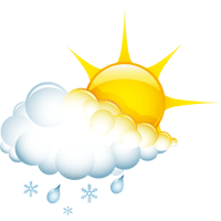
Temperature
3 °C / 14 °C
Sunshine hours
3 h


Forecast
Weather forecast
DAILY WEATHER IN DETAIL
THE WEATHER TODAY
A strong low-pressure system over Western Europe is causing a persistent lively to strong southerly airflow in the Alpine region. Until Thursday, dense clouds from the south will be directed towards the main Alpine ridge, leading to repeated orographic precipitation. Since the Mediterranean air being transported is very mild, the snow line will consistently remain above 2,000 meters above sea level. North of the main Alpine ridge, the southerly wind will have noticeable föhn effects, allowing clouds to break up significantly at times and providing longer sunny periods. Moreover, this area will remain largely free of precipitation. For Friday, a temporary end to the föhn conditions is anticipated. This could result in precipitation from the south spreading to the northern side of the Alps on Good Friday and during the Easter weekend. However, this change will not be accompanied by significant cooling. Additionally, due to the nature of this weather pattern, surprises in long-term trends are possible daily, leaving some uncertainty in weather developments.
Wetterstationen
LIVE REPORT
CURRENT TEMPERATUREs
ALL WEATHER STATIONS IN ISCHGL
Avalanche warning
3 Considerable
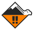
The avalanche warning level refers to the Austrian part of the ski area
Avalanche warning
2 Moderate
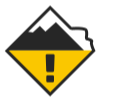
The avalanche warning level refers to the Swiss part of the ski area
Up to the minute
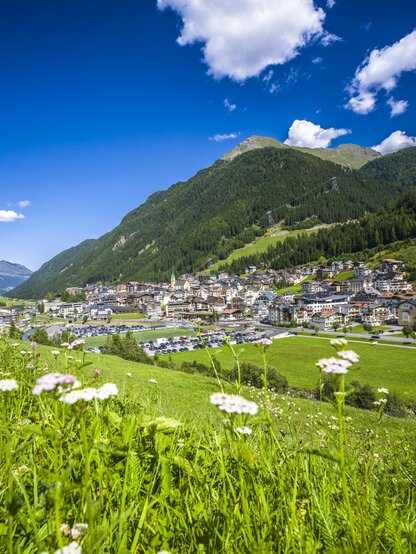
The weather in Ischgl
Real-time information from your holiday region
Sunscreen, windbreaker or umbrella? To come perfectly prepared for your holiday adventure in the Paznaun valley, it’s a good idea to have a look at the weather forecast. Weather you’re headed for a ski resort or the region’s hiking trails – we have all the information you need for your upcoming trip.
Our forecasts keep you informed on things like the snow line, sunshine hours, rain probability and the daily maximum and minimum temperature. Plus, we’ll keep you up to date on the average wind speed and the current avalanche warning level.